Hello,
I am trying to do mapping part of the project ros2 navigation.
In my project_mapping package which is in ros2_ws workspace, i created launch file named cartographer.launch.py in the launch directory as below;
import os
from launch import LaunchDescription
from ament_index_python.packages import get_package_share_directory
from launch_ros.actions import Node

def generate_launch_description():

    cartographer_config_dir = os.path.join(get_package_share_directory('project_mapping'), 'config')
    configuration_basename = 'cartographer.lua'

    return LaunchDescription([

        Node(
            package='cartographer_ros',
            executable='cartographer_node',
            name='cartographer_node',
            output='screen',
            parameters=[{'use_sim_time': True}],
            arguments=['-configuration_directory', cartographer_config_dir,
                       '-configuration_basename', configuration_basename]),

        Node(
            package='cartographer_ros',
            executable='occupancy_grid_node',
            output='screen',
            name='occupancy_grid_node',
            parameters=[{'use_sim_time': True}],
            arguments=['-resolution', '0.05', '-publish_period_sec', '1.0']
        ),
    ])
my cartographer.lua file in the config directory is ;
include "map_builder.lua"
include "trajectory_builder.lua"

options = {
  map_builder = MAP_BUILDER,
  trajectory_builder = TRAJECTORY_BUILDER,
  map_frame = "map",
  tracking_frame = "base_footprint",
  published_frame = "odom",
  odom_frame = "odom",
  provide_odom_frame = false,
  publish_frame_projected_to_2d = true,
  use_odometry = true,
  use_nav_sat = false,
  use_landmarks = false,
  num_laser_scans = 1,
  num_multi_echo_laser_scans = 0,
  num_subdivisions_per_laser_scan = 1,
  num_point_clouds = 0,
  lookup_transform_timeout_sec = 0.2,
  submap_publish_period_sec = 0.3,
  pose_publish_period_sec = 5e-3,
  trajectory_publish_period_sec = 30e-3,
  rangefinder_sampling_ratio = 1.,
  odometry_sampling_ratio = 1.,
  fixed_frame_pose_sampling_ratio = 1.,
  imu_sampling_ratio = 1.,
  landmarks_sampling_ratio = 1.,
}

MAP_BUILDER.use_trajectory_builder_2d = true

TRAJECTORY_BUILDER_2D.min_range = 0.12
TRAJECTORY_BUILDER_2D.max_range = 3.5
TRAJECTORY_BUILDER_2D.missing_data_ray_length = 3.0
TRAJECTORY_BUILDER_2D.use_imu_data = false
TRAJECTORY_BUILDER_2D.use_online_correlative_scan_matching = true
TRAJECTORY_BUILDER_2D.motion_filter.max_angle_radians = math.rad(0.1)

POSE_GRAPH.constraint_builder.min_score = 0.65
POSE_GRAPH.constraint_builder.global_localization_min_score = 0.7

-- POSE_GRAPH.optimize_every_n_nodes = 0

return options
i changed the setup.py of project_mapping as in the lesson;
from setuptools import setup
import os
from glob import glob

package_name = 'project_mapping'

setup(
    name=package_name,
    version='0.0.0',
    packages=[package_name],
    data_files=[
        ('share/ament_index/resource_index/packages',
            ['resource/' + package_name]),
        ('share/' + package_name, ['package.xml']),
        (os.path.join('share', package_name, 'launch'), glob('launch/*.launch.py')),
        (os.path.join('share', package_name, 'config'), glob('config/*')),
    ],
    install_requires=['setuptools'],
    zip_safe=True,
    maintainer='user',
    maintainer_email='user@todo.todo',
    description='TODO: Package description',
    license='TODO: License declaration',
    tests_require=['pytest'],
    entry_points={
        'console_scripts': [
        ],
    },
)
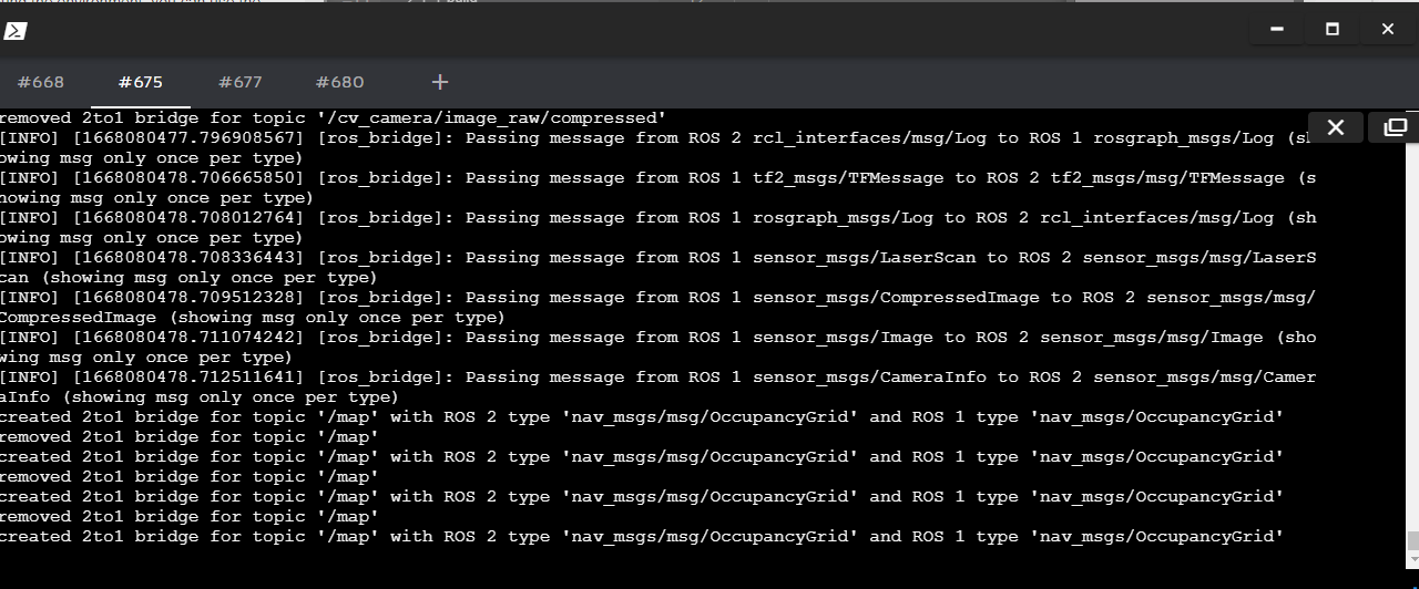
but when i launch the cartographer.launch.py i get an warning like below;
[occupancy_grid_node-2] [WARN] [1668015992.404121927] [occupancy_grid_node]: submap_slices and last_frame_id is empty

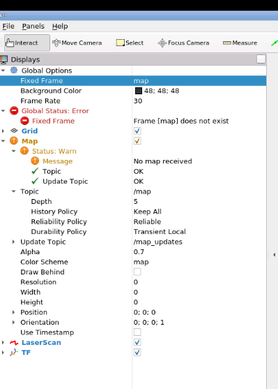
and in the rviz there is no map topic in the global options/fixed frame , and warning message saying “no map recieved” like in the image below
i could not figure out what may cause this problem , i hope anyone can give me an idea.
Thanks in advance.
Erdem