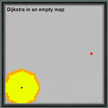
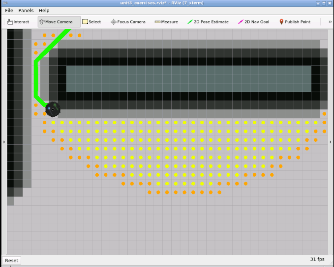
#! /usr/bin/env python

"""

Greedy Best-First Search path planning algorithm exercise

Author: Roberto Zegers R.

Copyright: Copyright (c) 2020, Roberto Zegers R.

License: BSD-3-Clause

Date: Nov 30, 2020

Usage: roslaunch unit3 unit3_gbfs_exercise.launch

"""

import rospy

from math import sqrt

def manhattan_distance(a, b):

  return (abs(a[0] - b[0]) + abs(a[1] - b[1]))

def euclidean_distance(a, b):

    # implement the body of this function

  return sqrt((a[0]-b[0])**2+(a[1]-b[1])**2)

def find_neighbors(index, width, height, costmap, orthogonal_step_cost):

  """

  Identifies neighbor nodes inspecting the 8 adjacent neighbors

  Checks if neighbor is inside the map boundaries and if is not an obstacle according to a threshold

  Returns a list with valid neighbour nodes as [index, step_cost] pairs

  """

  neighbors = []

  # length of diagonal = length of one side by the square root of 2 (1.41421)

  diagonal_step_cost = orthogonal_step_cost * 1.41421

  # threshold value used to reject neighbor nodes as they are considered as obstacles [1-254]

  lethal_cost = 1

  upper = index - width

  if upper > 0:

    if costmap[upper] < lethal_cost:

      step_cost = orthogonal_step_cost + costmap[upper]/255

      neighbors.append([upper, step_cost])

  left = index - 1

  if left % width > 0:

    if costmap[left] < lethal_cost:

      step_cost = orthogonal_step_cost + costmap[left]/255

      neighbors.append([left, step_cost])

  upper_left = index - width - 1

  if upper_left > 0 and upper_left % width > 0:

    if costmap[upper_left] < lethal_cost:

      step_cost = diagonal_step_cost + costmap[upper_left]/255

      neighbors.append([index - width - 1, step_cost])

  upper_right = index - width + 1

  if upper_right > 0 and (upper_right) % width != (width - 1):

    if costmap[upper_right] < lethal_cost:

      step_cost = diagonal_step_cost + costmap[upper_right]/255

      neighbors.append([upper_right, step_cost])

  right = index + 1

  if right % width != (width + 1):

    if costmap[right] < lethal_cost:

      step_cost = orthogonal_step_cost + costmap[right]/255

      neighbors.append([right, step_cost])

  lower_left = index + width - 1

  if lower_left < height * width and lower_left % width != 0:

    if costmap[lower_left] < lethal_cost:

      step_cost = diagonal_step_cost + costmap[lower_left]/255

      neighbors.append([lower_left, step_cost])

  lower = index + width

  if lower <= height * width:

    if costmap[lower] < lethal_cost:

      step_cost = orthogonal_step_cost + costmap[lower]/255

      neighbors.append([lower, step_cost])

  lower_right = index + width + 1

  if (lower_right) <= height * width and lower_right % width != (width - 1):

    if costmap[lower_right] < lethal_cost:

      step_cost = diagonal_step_cost + costmap[lower_right]/255

      neighbors.append([lower_right, step_cost])

  return neighbors

def indexToWorld(flatmap_index, map_width, map_resolution, map_origin = [0,0]):

    """

    Converts a flatmap index value to world coordinates (meters)

    flatmap_index: a linear index value, specifying a cell/pixel in an 1-D array

    map_width: number of columns in the occupancy grid

    map_resolution: side lenght of each grid map cell in meters

    map_origin: the x,y position in grid cell coordinates of the world's coordinate origin

    Returns a list containing x,y coordinates in the world frame of reference

    """

    # convert to x,y grid cell/pixel coordinates

    grid_cell_map_x = flatmap_index % map_width

    grid_cell_map_y = flatmap_index // map_width

    # convert to world coordinates

    x = map_resolution * grid_cell_map_x + map_origin[0]

    y = map_resolution * grid_cell_map_y + map_origin[1]

    return [x,y]

def greedy_bfs(start_index, goal_index, width, height, costmap, resolution, origin, grid_viz = None):

  '''

  Performs Greedy Best-First Search on a costmap with a given start and goal node

  '''

  # create an open_list

  open_list = []

  # set to hold already processed nodes

  closed_list = set()

  # dict for mapping children to parent

  parents = dict()


  # dict for mapping h costs (heuristic costs) to nodes

  h_costs = dict()

  # determine the h cost (heuristic cost) for the start node

  from_xy = indexToWorld(start_index, width, resolution, origin)

  to_xy = indexToWorld(goal_index, width, resolution, origin)

  h_cost = euclidean_distance(from_xy, to_xy)


  rospy.loginfo(h_cost)

  # set the start's node h_cost

  h_costs[start_index] = h_cost

  # add start node to open list

  open_list.append([start_index, h_cost])

  shortest_path = []

  path_found = False

  rospy.loginfo('Greedy BFS: Done with initialization')

  # Main loop, executes as long as there are still nodes inside open_list

  while open_list:

    # sort open_list according to the lowest 'g_cost' value (second element of each sublist)

    open_list.sort(key = lambda x: x[1])

    # extract the first element (the one with the lowest 'g_cost' value)

    current_node = open_list.pop(0)[0]

    # Close current_node to prevent from visting it again

    closed_list.add(current_node)

    # Optional: visualize closed nodes

    grid_viz.set_color(current_node,"pale yellow")

    # If current_node is the goal, exit the main loop

    if current_node == goal_index:

      path_found = True

      break

    # Get neighbors of current_node

    neighbors = find_neighbors(current_node, width, height, costmap, resolution)

    # Loop neighbors

    for neighbor_index, step_cost in neighbors:

      # Check if the neighbor has already been visited

      if neighbor_index in closed_list:

        continue

      # pure heuristic 'h_cost'

      from_xy = indexToWorld(neighbor_index, width, resolution, origin)

      to_xy = indexToWorld(goal_index, width, resolution, origin)

      h_cost = euclidean_distance(from_xy, to_xy)

      #h_cost = manhattan_distance(from_xy, to_xy)

    #   print("h_cost=",h_cost)

      rospy.loginfo(h_cost)

      # Check if the neighbor is in open_list

      in_open_list = False

      for idx, element in enumerate(open_list):

        if element[0] == neighbor_index:

          in_open_list = True

          break

      # CASE 1: neighbor already in open_list

      if in_open_list:

        if h_cost < h_costs[neighbor_index]:

          # Update the node's heuristic cost

          h_costs[neighbor_index] = h_cost

          parents[neighbor_index] = current_node

          # Update the node's h_cost inside open_list

          open_list[idx] = [neighbor_index, h_cost]

      # CASE 2: neighbor not in open_list

      else:

        # Set the node's heuristic cost

        h_costs[neighbor_index] = h_cost

        parents[neighbor_index] = current_node

        # Add neighbor to open_list

        open_list.append([neighbor_index, h_cost])

        # Optional: visualize frontier

        grid_viz.set_color(neighbor_index,'orange')

  rospy.loginfo('Greedy BFS: Done traversing nodes in open_list')

  if not path_found:

    rospy.logwarn('Greedy BFS: No path found!')

    return shortest_path

  # Reconstruct path by working backwards from target

  if path_found:

      node = goal_index

      shortest_path.append(goal_index)

      while node != start_index:

          shortest_path.append(node)

          # get next node

          node = parents[node]

  # reverse list

  shortest_path = shortest_path[::-1]

  rospy.loginfo('Greedy BFS: Done reconstructing path')

  return shortest_path

